Map Mobile Navigator (MapNav) is free navigation application for mobile phone with Java support MIDP-2.0 and GPS-receiver (Bluetooth or embedded, and other).You can take screenshots from map or any other information screens and save it in BMP or GIF format file, or send it by MMS.
Month: February 2010
mSync v1.01 Application For Java Mobile Phones
mSync is a mobile application can help you back up phone contacts, files, and settings.Easily transfer key information from your old mobile phone to your new mobile phone.
Cellflare Location Based Service Application For Java Mobile Phones
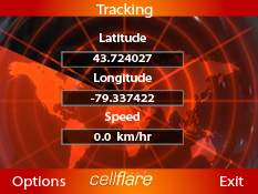
Cellflare is a location based web service that allows you to follow mobile devices in real time.With Cellflare you can let your friends and family members know where you are by turning your cell phone into a real time locating device. All you require is a GPS enabled cell phone and a data plan, then you are all set! Currently we support the following cell phone operating system.
GyPSii – Geotag Videos and Photos Application For Java Mobile Phones
With GyPSii mobile you can:
- Create photos and videos tagged to a location with your mobile phone.
- Connect by locating friends, finding ones commenting on people, places and update.
- Explore what’s happening and where, the places people recommend, points of interest nearby and view it all on a map.
- Share content with friends or the whole community and automatically update other networks.
jibjib – Twitter client for Java Mobile Phones
jibjib is another open source J2ME Twitter client designed for all twitter’s on the road. One hand controls the wheel and another hand tweets along the road.
TrekBuddy – GPS tracking and navigation Application For Java Mobile Phones
TrekBuddy is a freeware GPS navigation and tracking application for Java J2ME mobile devices.
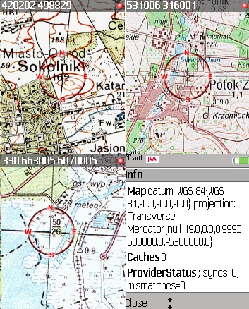
GpsMid – vector based map application for Java Mobile Phones


GpsMid is a Java J2ME mobile application with use OpenStreetMap Data. it’s free, fully offline, vector based map application for your cellphone. It displays your current position on a zoomable map and can be used to search for and navigate to roads or points of interest of your liking. There is also Navigation support for car driver, biker and pedestrians.